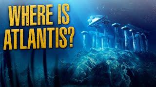
Top 10 Facts Atlantis Was a Real Place, and New Book
Description
Remember to subscribe, like, comment, share!
↓↓↓ More info and sources below ↓↓↓
Books:
Mission: Atlantis
Proof of Atlantis?
Atlantis: Evidence
currently available at http://TharsisHighlands.WordPress.com/books/history/
and major online retailers.
Atlantis: Location
Atlantis: Geology
coming soon...
KEYWORDS AND CONCEPTS:
#Atlantis #Science #Geology #Plato #Evidence
logical fallacies, geologist, L. Sprague de Camp, Mission: Atlantis, skeptics, book, critical thinking, Top 10 Facts, facts, hypothesis, genetics, mtDNA haplogroup x, Mitochondrial DNA, archaeology, megalithic structures, earliest civilization, Basques, Native American, Ojibwa, Sioux, Navaho, Atlantic Ocean, anthropology, cro magnons, Anthropologists, tectonic plate, Azores, Gibraltar, topographical map, underwater plateau, Terceira Ridge, Younger Dryas, Lake Agassiz, Gulf Stream, thermohaline, Greenland, ice cores, volcanic region, active volcanoes, GISP2 ice core, volcanic eruption, proxy data, mountains, islands, tectonic margins, convergent, transform, divergent, earthquakes, Mid-Atlantic Ridge, Terceira Ridge, subduction, compressive folding, orogeny, mountain building, North Atlantic triple junction, Hagstrum, asteroid, meteorite, Azores hot spot, impediment to subduction
REFERENCES
de Camp, L. Sprague. (1954). Lost Continents
http://AtlantisQuestScience.WordPress.com
Fairbanks, R. (1989:12). “A 17,000-year glacio-eustatic sea level record: influence of glacial melting rates on the Younger Dryas event and deep-ocean circulation.” Nature, Vol. 342, 7 December 1989.
Hagstrum, J. T. (2005). “Antipodal hotspots and bipolar catastrophes: Were oceanic large-body impacts the cause?” Earth Planet. Sci. Lett., 236, 13-27, 2005.
Jimenez-Munt, I., et al. (2001). “Abstract: The transition from linear to diffuse plate boundary in the Azores-Gibraltar region: Results from a thin-sheet model.” Retrieved on 2006:0716 from http://peterbird.name/publications/2001_Iberia_UHURU/2001_Iberia_UHURU.htm
Little, Dr. Gregory L. (2001:08). “DNA analysis on Native Americans.” Retrieved on 2020:0322 from https://bibliotecapleyades.net/ciencia/ciencia_adn05.htm
Martin, Jr., Rod. (2020). Mission: Atlantis.
Navarro, A.; Catalão, J.; Miranda, J. M.; Fernandes, R. M. (2003:10). “Estimation of the Terceira Island (Azores) main strain rates from GPS data.” Earth, Planets and Space, Volume 55, p. 637-642.
NOAA. (ND). “GISP2 Volcanic markers.” Retrieved on 2009:0325 from ftp://ftp.ncdc.noaa.gov/pub/data/paleo/icecore/greenland/summit/gisp2/chem/volcano.txt
NOAA. (ND). “The Younger Dryas.” Retrieved on 2019:1224 from https://ncdc.noaa.gov/abrupt-climate-change/The%20Younger%20Dryas
Plato; Lee, Desmond (trans.). (c.360 BC). Timaeus and Critias. Penguin Books (1977): New York.
Searle, R. (1980). “Tectonic pattern of the Azores spreading centre and triple junction.” Earth and Planetary Science Letters, v. 51, p. 415-434.
Silveira, D., et al. (2003). “Reassessment of the historical seismic activity with major impact on S. Miguel Island (Azores).” Natural Hazards and Earth System Sciences (2003) 3: 615-623.
STILLS:
Stills CC0 via Pixabay unless otherwise noted
Azores lake: Comanche0
Azores sunset: RSilveiraphotography
Textile pattern: Virin000
Paper: ChrisFiedler
Atlantis region of NE Atlantic: Gebco World Map (detail)
Nassau Hall, Princeton University: Library of Congress (PD)
Heinlein, de Camp and Asimov (PD)
Eupedia map of mtDNA haplogroup X: © Maciamo Hay, Used w Permission
Trilithon, Baalbek, Lebanon: Courtesy AtlantisQuestScience.WordPress.com
Göbekli Tepe, Turkey: Benefits (CC BY-SA 3.0)
Blank world map: Wikimedia (CC BY-SA 3.0)
Lascaux Horse: (PD)
Altamira Bison: Rameessos (PD)
Tectonic plates boundary map: Eric Gaba (CC BY-SA 2.5); data: Prof. Peter Bird
Bathymetry of NE Atlantic: Courtesy Ifremer
Hypothetical Atlantis map: © Rod Martin, Jr.
Timeline 800k years temperature and CO2, EPICA Dome C
19th century Lake Agassiz map (PD)
Mt. Pico, Azores: Tresa
Mt. St. Helens eruption: USGS (PD)
17,000 years of sea-level rise, graph: R. Fairbanks, © 1989, Nature magazine
3 tectonic boundary diagrams: DomDomEgg (CC BY 4.0)
San Andreas fault, Carrizo Plain: John Wiley (CC BY 3.0) and Ikluft-(CC BY-SA 4.0)
San Andreas map: USGS (PD)
Himalayas: Landsat 7, NASA (PD)
Mt. Everest: Shrimpo1967 (CC BY-SA 2.0)
Earth: NASA (PD)
Aiguille du Midi, Mont Blanc massif, France: Martin Janner (CC BY-SA 3.0)
VIDEOS:
Thermohaline conveyor: NASA (PD)
Mega-Tsunami Movie Clips, courtesy: DreamWorks Pictures and Columbia Pictures
Scotese Plate Tectonics Paleogeography & Ice ages, https://youtube.com/watch?v=UevnAq1MTVA
MUSIC:
Cameras: Albis (YouTube audio library)


Comments